Monday 17 December 2012

Bay of Islands - Hole in the Rock

North to the Bay of Islands

Bottlenose Dolphin in the Bay of Islands
Waitangi Treaty Grounds


Our last bus tour took us out of Auckland to the north, to where the guide claimed "that New Zealand really started", the Bay of Islands. This area was occupied by whalers and loggers in the early 19th century. The area was a "wild west". No law and few rules. The problems got so bad that the Maori leaders were motivated to sign a treaty with the British to have them impose law and order in the area. Unfortunately, the Maori version of the treaty and the English version have quite different interpretations, a source of ongoing conflict right up to present day. Sounds very familiar to someone from Canada. I'd say first nations relations are quite similar, and for similar reasons. Land confiscated with little or no compensation is hard to overcome.

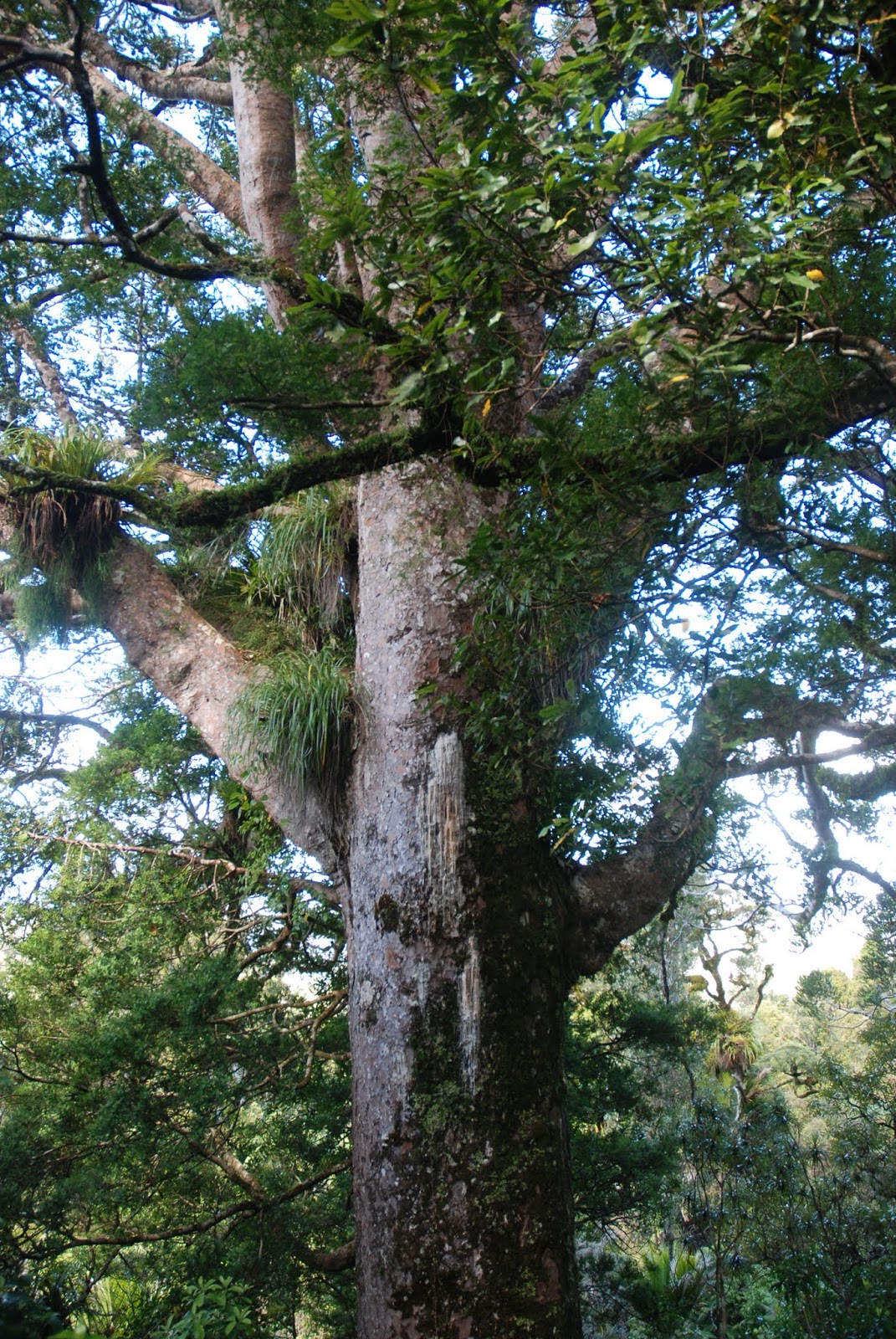
Frank hugs the Kauri Tree
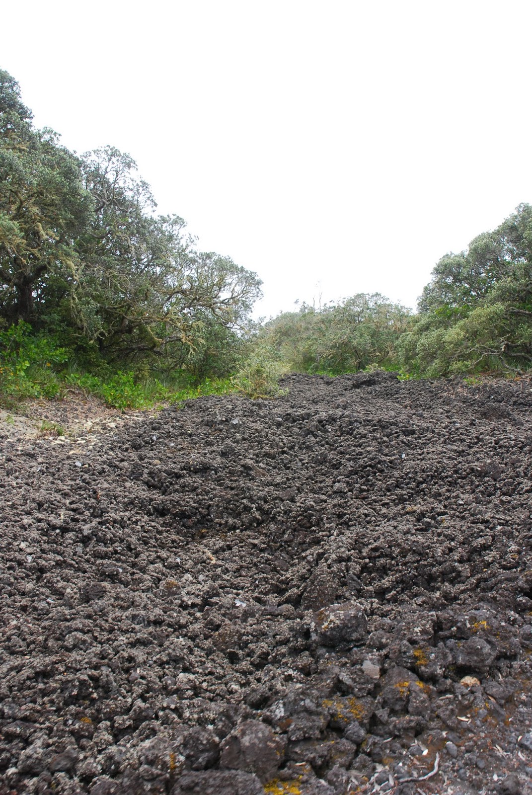
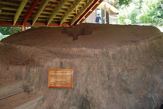
On the way north, we stopped for tea at a roadside cafe, and for a view of an 800 year old McKinney Kauri Tree. These trees were quite common in the 19th century, but have been mostly logged out of existence. They grow so slowly. It will take a long time for them to come back, even with our help. Makes me want to be a "tree hugger" :-)

Maori Meeting House at Waitangi


Interior of the Meeting House

Our Waitangi Guide explains the Treaty
Sundial in the Busby House Garden
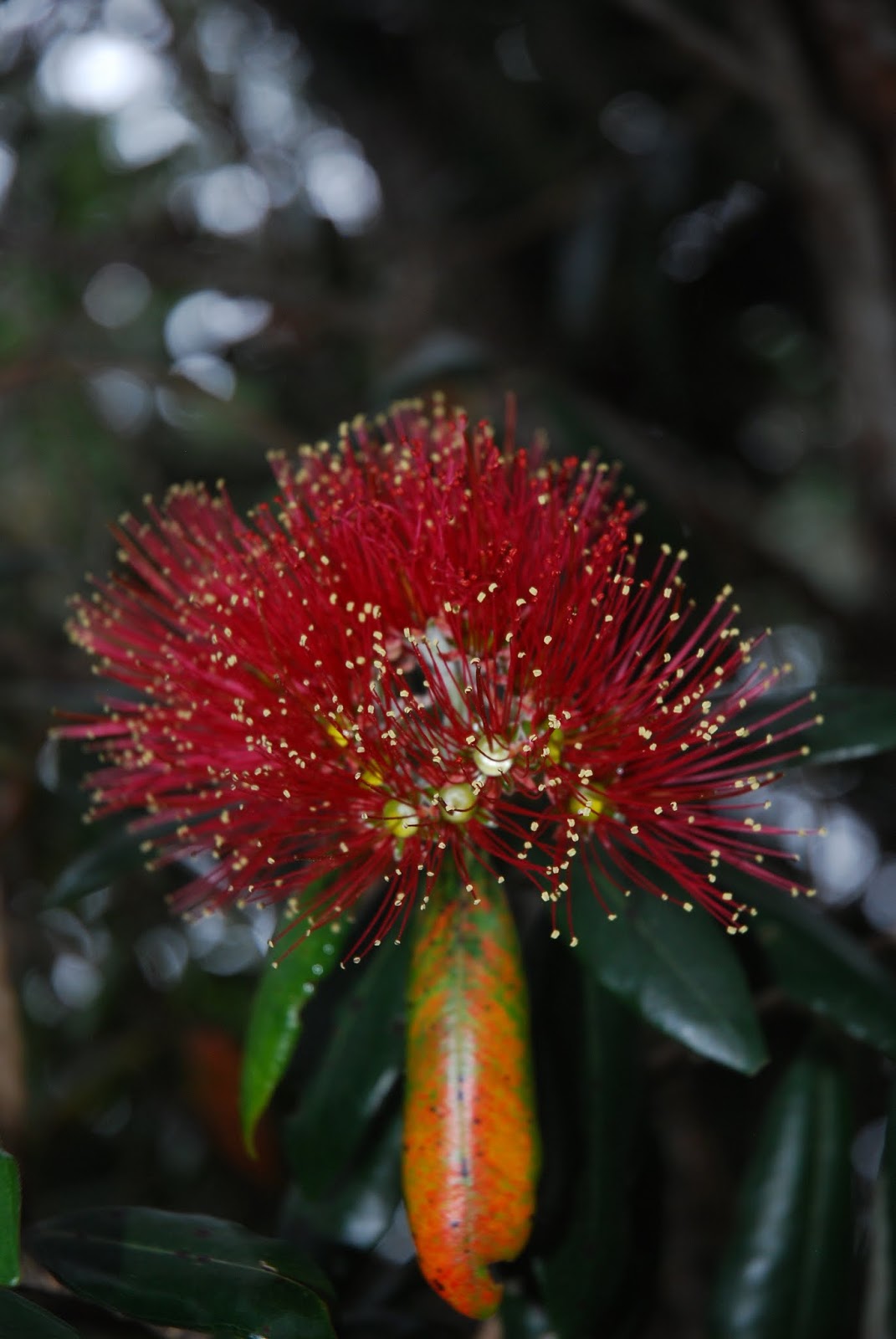
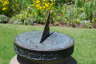
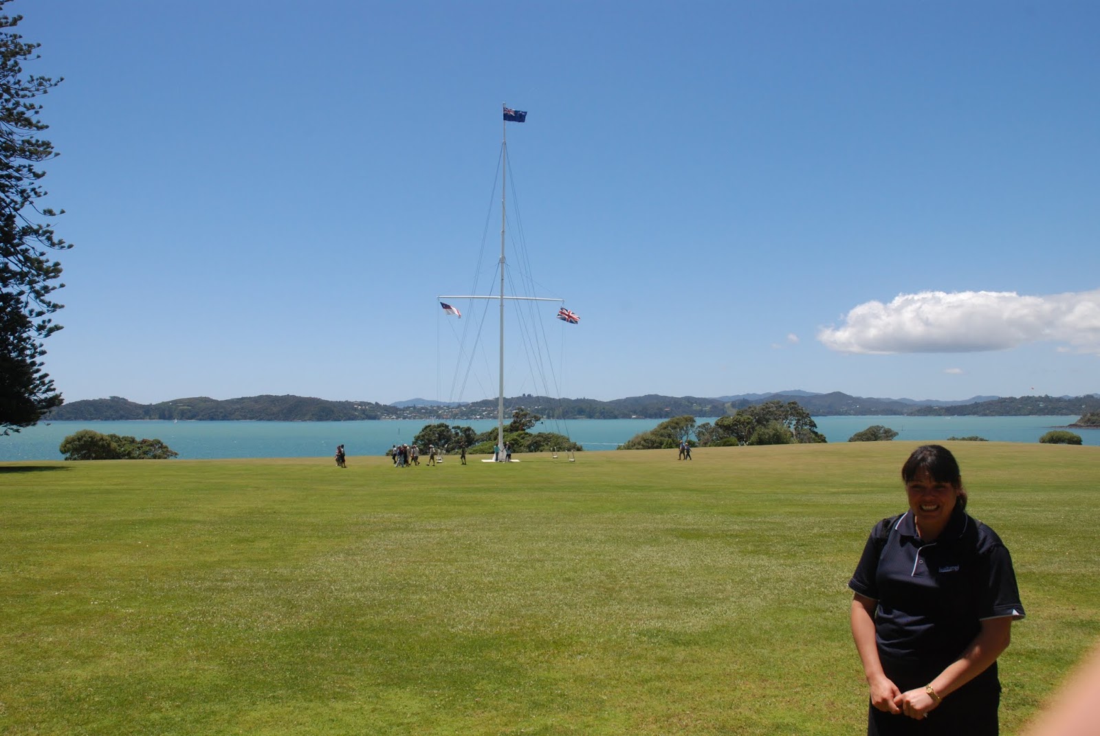
Due to problems with the pickup of participants and traffic out of Auckland, we were most of an hour behind schedule when we arrived in Paihia, so we went straight to the Waitangi Treaty Grounds. The bus drive turned us over to a lovely young lady who told us she could trace her lineage back to signatories of the treaty on both Maori and English sides. She took us to the Maori Meeting House and sang us a lovely Maori love song in greeting. Then she took us to the grounds where she explained briefly the nature of the Maori-English Treaty and the circumstances that brought it about. An English country house that also resides on the grounds. Once occupied by James Busby, British Resident in New Zealand, and family. It had a very beautiful garden. The house is now a museum, showcasing what life must have been like, and how the house was constructed from a kit-type approach, with all the joints numbered with Roman numerals.


Three of these trees make a Waka
Waka
Our guide then showed us the huge Maori Waka, or canoe, built to celebrate the centenary of the signing of the treaty in 1840. The canoe is a ceremonial war canoe that was built from three Kauri trees and takes 800 men to lift. They have built tracks to allow it to be launched with fewer men and avoid carrying it down to the water once a year for the ceremonies celebrating the treaty.
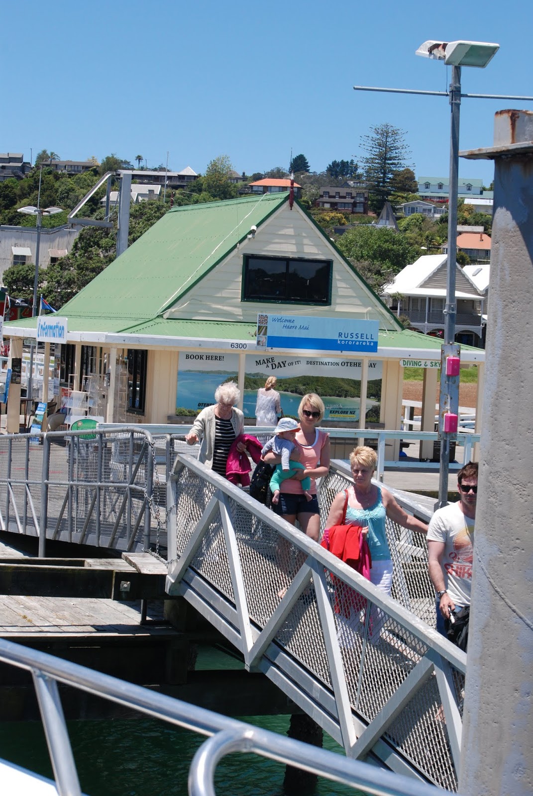


Russell Ferry Dock
20 knots across the Bay of Islands


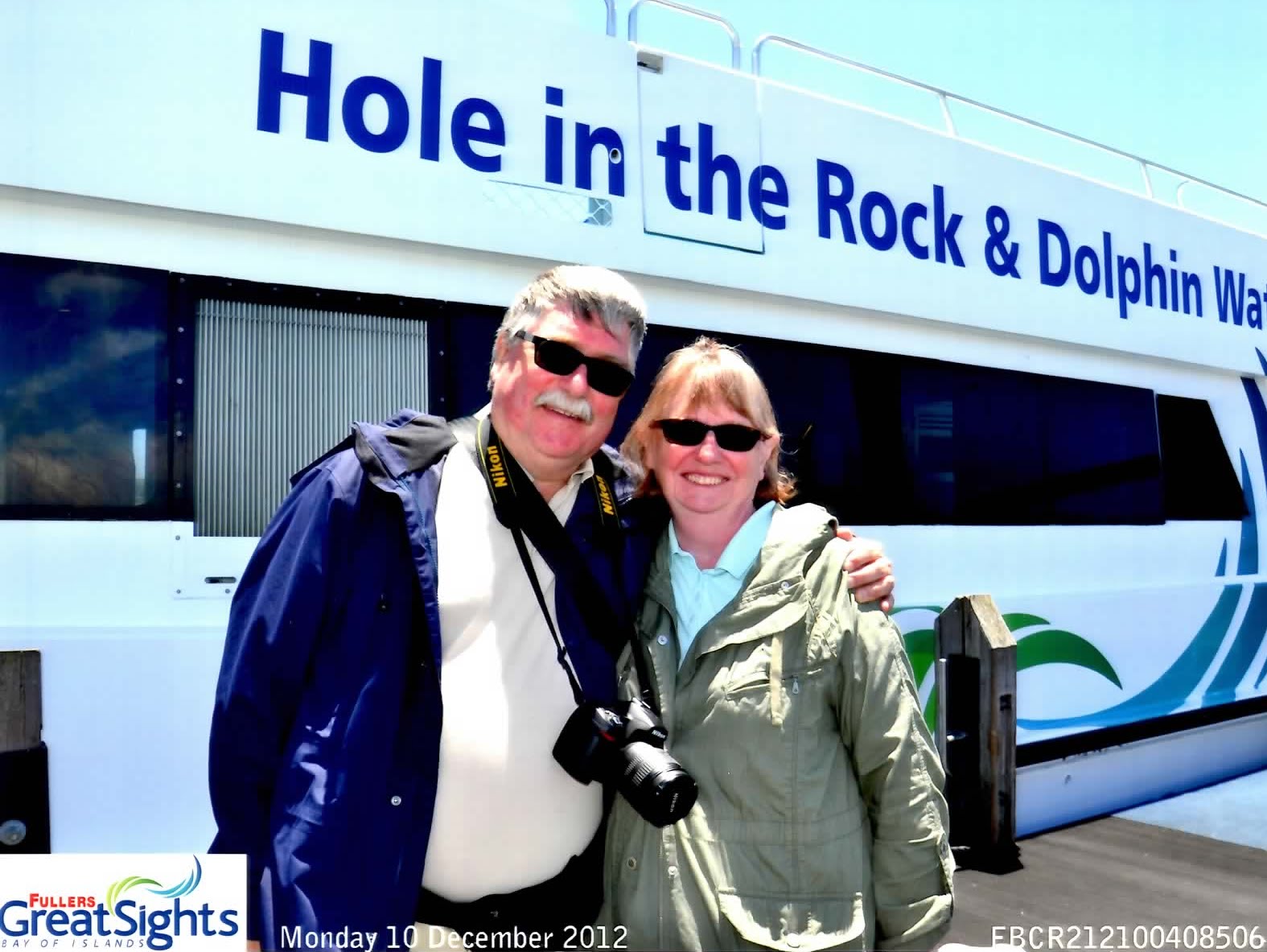
Us boarding the boat
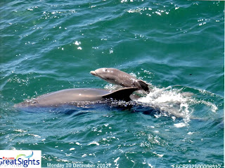
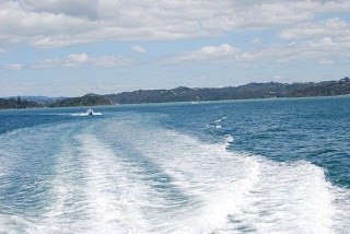
Back on the bus and down to the Paihia docks to catch the "Dolphin Explorer" for a cruise of the Bay of Islands. First stop Russell, the first capital of New Zealand, to pick up more passengers. Russell is on a peninsula, but is most often reached by ferry these days. We were fortunate to find a pod of bottlenose dolphins soon after leaving Russell. The pod included a very young one, just weeks old. There was a young photographer onboard who took our picture when we boarded. She got an excellent shot of the baby, which she gave us with the CD we purchased.

The weather could not have been nicer, light winds, perfect temperature, and not a cloud in the sky on our run out across the Bay of Islands to Hole in the Rock. Very relaxing. Nice end to our journey south of the equator and tomorrow is today.


Tall ship leaving port Russell
Through the Hole in the Rock
Yes, we did get to take the boat through the Hole. And visit the dolphin pod on the way back as well. We switched boats in order to make our bus back to Auckland. A tall ship was departing as we arrived back in Russell. I cannot image travelling to England in one of those, taking months to do so.

This tour was full of new and wonderful sights, but the 8 hours of bus riding was too much. I'd recommend doing what several of our fellow tourists did. Stay overnight, or more, in Piahia rather than go back to Auckland with the bus the same day.

Friday 14 December 2012

Auckland Day

Auckland City


Rose Garden Auckland

Auckland City has 1.5 million people scattered over a vast area of a thousand square miles on top of, with 50 or more dormant(?) volcanoes. Different guides gave different numbers. Our guide for this morning, Tony, was from the Bush and Beach Company providing small bus excursions.
Auckland War Memorial and Museum
We ventured around the Auckland CBD (Central Busness District) streets with highlights stops at: a rose garden; the museum and war memorial;


the "Wintergarden", a flower garden with a hot house, a cool house, and a native garden;


Yours for $60 million NZ
a marina, of which there are 9 in the City (1 in 5 people own a boat in Auckland);


and a panoramic viewpoint on top of an old volcano on the north side of the harbour where the Harbour Master use to live and work.


An interesting tale about the Harbour Bridge is it has clipon roads attached to both sides. The original bridge was 4 lanes, but as the area grew more lanes were needed. So a company in Japan devised sections that sections could be “clipped” on to add 2 extra lanes each side. "Nippon Clippons", rather a neat way to solve the capacity problem. But now the capacity is again too small, so a tunnel. like Sydney Harbour, is probably next, after they finish the huge one to the airport currently under construction.

In the afternoon we switched guides and were taken west of the downtown into the Waitakere Ranges, the city's largest regional park, and where their drinking water comes from. It forms a natural barrier between the city and surf beaches on the Tasman Sea to the west. Our first stop was at the Arataki centre where one gets great views of Auckland CBD, the Sky Tower and the 2 Harbours of Auckland, plus in the far distance, the Pacific Ocean to the east.

A short trek in the forest we came upon a beautiful waterfall, in the Karekare area. From the storm a couple of days before a new pile of rocks was sitting at the edge of the pond.


Back to our van we drove very narrow twisty roads to the Piha area to the a beach. The guide brought a magnet to show us what was in the sand, black iron and titanium made up 85% of the sand, which stuck easily to the magnet. We weren't prepared for this stop and kept our shoes on as we found the sand quite hot. Lots of people were enjoying the water with surf about 4-5 ' high. One of the rock formations is looks like a lions head thus it's name. Some afternoon tea was served before, we headed to a lovely spot a lady fell in love with. Who wouldn't?


The final stop was to see a 800 year old Kuari tree. As the tree grows it drops the bottom branches, so the yellow wood has almost no knots. A delightful day again.


rotoura

Rotorua and Waitomo Glowworms


Huntly Power Station
Our next trip out of Auckland was to our furthest south destination in New Zealand, the City of Rotorua. It was a mixed bag of weather, nothing like the previous day which had included a tornado that claimed two lives in north Auckland. The showers mostly happened while we were en route between adventures. On the way we passed the coal and natural gas fired power plant that supplies electricity to Auckland, and may fields filled with cows, which outnumber people in New Zealand 6 million to 5. They are down to just 30 million sheep from a peak of 60 million. We also drove by the Maori King's house. The King was created by the Maori to negotiate with the British crown over land rights.
Typical Pasture

Maori King's Gate
Our first stop was to visit the Glowworm Caves, located in the Waitomo area, meaning “Water entering a hole in the Ground”. Our tour guide escorted us through, the Aranui Cave, a maze of limestone beauty where the dripping water from the roof over the cave walls leaves deposits of crystalline calcium carbonate forming amazing stalactites from the ceiling and stalagmites growing up from the ground. It has been estimated that it takes a 100 years to from a 1 cubic inch of stalactite. We were also told if the water drops on you, you are a lucky person. Frank had two droplets and Linda had four, one down her back neck. Part of the cave is an area referred to as the Cathedral. Because of its shape and height, people gather there to sing. It doesn't echo, but gives harmony to the voices, so good are the acoustics. As we journeyed deeper into the caves where it is much darker, one started to see the Glowworms. It is the larval stage of a winged insect that gives off the light. They have around 30 extremely fine lines hanging down which catch the food that is attracted by their bioluminecent light. The insects display similar to a star constellation. At our deepest penetration we boarded a large flat-bottom boat to travel the waterway inside the cave. Pitch black, the guide has series of cables to reach up and pull us along as we see the stunning, breathtaking Glowworms!!! Sorry no pictures allowed. Flashes disturb the glowworms.


Back aboard our bus, a box lunch was served as we continued on to our next stop, the Agrodome Complex, a New Zealand farm. We boarded our covered wagon, bouncing along being pulled by a tractor through pastures to see the animals closeup. The different types of cows, farm raised red deer, alpacas, Ostriches and sheep. When we arrived the sheep and lambs came scurrying over as they knew what was going to happen. FOOD from the visitors. We were given handfuls of kibble type food and were targeted to get as much as possible. One of the alpacas helped itself to a container left on the seat of the  wagon. From there to a pigpen with 2 grownups and 3 piglets, all black, came for there turn at the food. The guide was the only one to feed them as they aren't as careful in what they munch on. The Ostriches were next. They quickly pecked the food from your straight out hand.
The next stop was at a small corral where Queen the dog gave us a “Sheep Dog” demonstration of her skills with 5 sheep. Obeying whistle tones and voice commands, she showed her skills. Afterwards we had a sheep sheering demonstration with the guide managing to have the years wool accumulation come off in one big piece. We were then shown how the fibre is combed, twisted into thread and then woven on huge machines.


Leaving here we were onto our final stop the Maori Arts and Crafts Institute where we had a performance of the Poi dance, singing in harmony, the use of the haka and the Tititorea, stick games. The performance was disrupted by another bus group getting up to video and take pictures. They were requested to go to the sides but just doing this interrupted the performance for others. Our guide asked us how it was and we made the comment. They are aware of the problem and are trying to resolve this issue.
Pohutu Geyser


Next we walked through a life size replica of a traditional Maori Village. One of the units was up on stilts, which stored the food goods. The height was to keep the animals from getting into the food. We continued on through the geothermal area of the hot bubbling mud pools and the famous Pohutu Geyser. The final part was viewing Maori carvings and flax garment weaving. They teach people these trades and then they take the skills back to the tribes to pass on.

Matamata Visitors Centre

Linda Enters the Hobbit Hole
Aboard the bus heading back to Auckland an unplanned short trip was to stop in the town of Maramata, the town where the Hobbit was filmed. We came across a Hobbit House which is being used as a visitors centre. There is a day trip to the Hobbiton to see the largest green movie set. The day ended at about 8:15 pm, but well worth the time travelling.
Rainbow from our Bus

Thursday 13 December 2012

Rangitoto

 Rangitoto

Rangitoto Island with the sun out days later


 600 year-old lava
Our first day we had an afternoon tour of Rangitoto Island. A short ferry ride across the harbour brought us to this lava based island which erupted from the sea floor about 600 years ago. Today it is still covered in lava as it apparently takes about a 1000 years for soil to develop. Lots of natural floral and fauna some being very rare and over 400 native plant species with 40 different fern types, grow on the island. The Pohutakawa is just starting to bloom and will have the island covered in red blossoms just around xmas.

Pohutakawa Flower


Tractor pulling wagon of wet tourists


We climbed aboard our train, a 4 wheel tractor pulling a seated wagon, for our Volcanic Exploration tour. We ended up being part of a school tour with two gals sitting next to us, Myah and Chantrel grade 9 students who were very friendly and inquisitive. They were on a tour with their class from Tauranga.


At the top of Rangitoto


Kids try the water
As we jostled along the lava made road, the guide told us the stories how the island became under the protection of the government. Several people in the past tried to change the island by introducing foreign animals and plants, but were stopped as it was destroying the natural vegetation that they wanted to preserve. We first stopped at the base of the summit cone for a climb of 300 steps to get to the top to see the crater. Unfortunately, this was a cloudy showery day and couldn't see much at all, but we did get to the top. From here we viewed more terrain on the western side of the island and stopped for a few minutes to walk on the lava.....not easy.... before returning to the wharf.

A few “batches”, (basic cottage no running water, electricity) remain on the island with no permanent residences. You can tour the island yourself with many tracks and one to some lava caves, to explore which we didn't have time for. One can even backpack and stay on the island camping with you bringing and taking away everything you need.